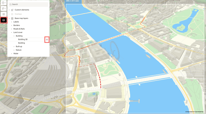
By default, map styles include a hidden 3D buildings layer. To activate it, click the eye icon next to it in the Layers menu. Make sure your zoom level is above 14 and the map is tilted to see the effect. Since the buildings are semi-transparent, all labels and any elements you’ve added will remain visible.
When exporting an interactive map, you can choose whether to restrict viewers from panning and zooming, or allow them to take a walk through the 3D city.
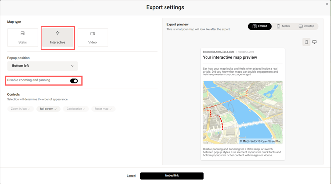
Zooming and panning restricted
Zooming and panning allowed
You can also export and publish your map online as a raster or vector image (PNG, JPG, SVG, TIFF, or PDF). Static export also supports other 3D options like 3D Terrain and Globe view. You can read more about them in these articles:
- 3D Terrain
- Globe