This documentation is always evolving.This article focuses on the previous version of Mapcreator and its features. For this article about Mapcreator Next click here.
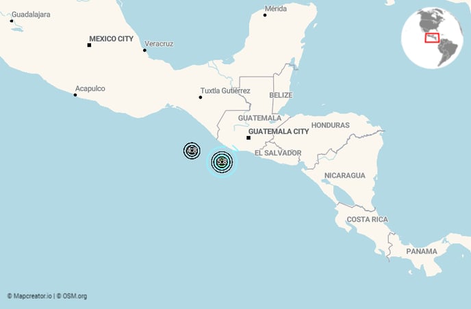
Need a map with the latest earthquake, including so-called shakemaps that shows the impact of the earthquake in its surroundings? We have a live layer with the latest USGS data for you, available in Data Layers. Every 30 minutes, this layer is updated from the latest USGS data and will contain all earthquakes from the last 6 days, ordered by the day you’re viewing them.
This is how you can get it to work:
Select the Earthquake Layer from the list of Data Layers. If you don’t find this layer in your menu, please contact our Support Team.
In the list of data, you now see two groups: Quake and Shakemap
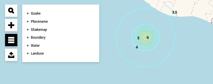
Each earthquake has one to three components: its location, the labels of the shakemap with the intensity as measured locally (labels) and the intensity isolines (shakemap). Shakes are easily identifiable as they are named with the day, time (24h format) and magnitude (Wed 11:12 (5.6)). The icon/magnitude are in location, the intensity labels in labels and the iso-lines in shakemap, under shakemap. All are placed in a logical order.
In order to make the largest earthquakes easy to find, all earthquakes with magnitude smaller than 5.0 are initially turned off.
How to get this map updated:
If you’d like to show this map on your website, we recommend you download this map as an iframe. The map published on your website will then also automatically update every 30 minutes.
And on a static map?
That’s very simple. Go to “Open Project” to look for this map you’ve already previously created. Reload your map and it will automatically also have the most recent data of the quakes. Download your map again and you’re ready.
Important note:
As more data becomes available hours or days after an earthquake, it is likely for the magnitude value to be corrected. As Mapcreator's live data layer receives regular updates directly from the source USGS, these corrected values will become available on your maps too. More information here.